[Copyright Notice]
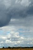
Recent Australian Tornadoes, Waterspouts and Funnel Clouds
[Tornadoes Home] [Tornado Alley Tornadoes]
Australian Tornadoes: [Recent Years] [2002 to 2005] [1989 to 2001]
|
Tornadoes &
Funnel Clouds
[Copyright Notice] |
Recent Australian Tornadoes, Waterspouts and Funnel Clouds [Tornadoes Home] [Tornado Alley Tornadoes] Australian Tornadoes: [Recent Years] [2002 to 2005] [1989 to 2001] |
|
If you have any photos or video of funnels or tornadoes taken in Australia and wish to have them displayed on this website, please contact us.
See also: |
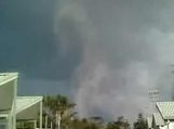
An "outbreak" of waterspouts was observed over the 2-3 May 2009 along the NSW coast. Several were photographed. One of the events on 2nd May came ashore at The Entrance on the Central Coast. This tornado caused damage to a caravan park and injured some people. Video Clip
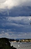
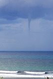
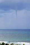
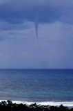
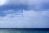
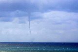
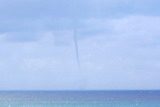
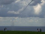
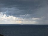
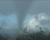
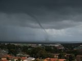
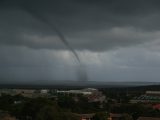
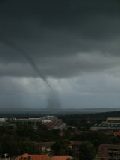
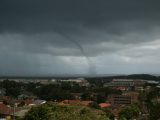
A number of waterspouts were observed off Sydney on the 2nd May. This first photo taken from Clifton Gardens is by James Harris. The second photo was taken from Cronulla, and the third shows three waterspouts and a funnel cloud at once!
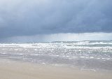
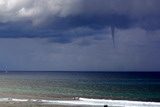
On Sunday 3rd May two seperate waterspouts were observed from the NSW Far North Coast. The first was seen off Lennox Head leading up to 3pm. These photos by Paul:
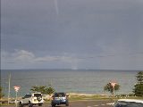
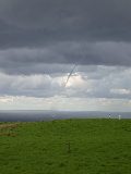
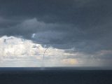
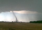
About 10km to the north and an hour later, a long-lived waterspout was photographed by a number of people as it moved northwards off Cape Byron. This was associated with a thunderstorm. The first three photos were taken by Tina Morris.
See also : Forum discussion
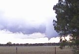
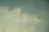
These images of a funnel cloud were taken by Kristy Norman at 5.10pm 25th April 2009 near Corowa, NSW
See also : Forum discussion
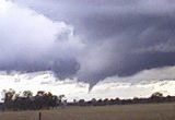
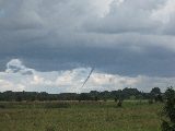
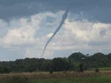
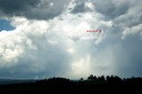
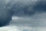
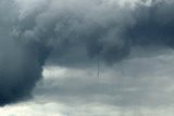
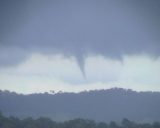
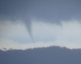
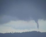
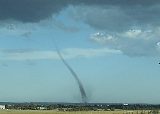
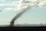
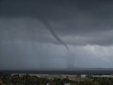
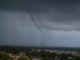
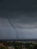
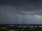
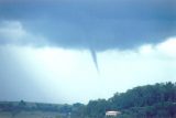
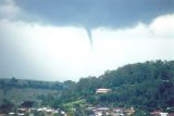
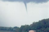
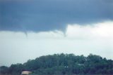
A spectacular landspout tornado near Cummins on the Eyre Peninsula, SA. These pictures were taken on 11th March 2009.
See also : Forum discussion
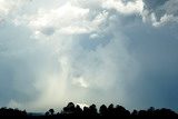
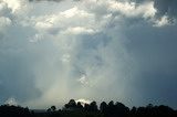
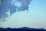
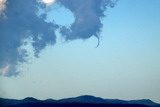
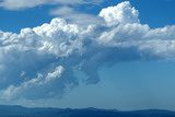
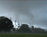
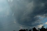
 The conditions on 30th December were volatile though only one thunderstorm managed to break the cap in the Northern Rivers region. It rapidly became a low precipitation supercell southwest of Lismore before transitioning into a classic supercell by the time it passed out to sea just north of Byron Bay. Several funnel clouds were observed during its life-cycle. This first photo is by Gaylee Kuchel showing a funnel under a wall cloud passing over Lismore.
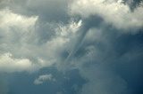
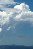
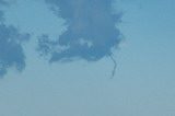
The remaining photos taken at McLeans Ridges are by Michael Bath. They depict a mid-level funnel persisting at the back of the supercell. By the last photo there are two funnels. The full sequence of pictures taken on the day is available here.
See also : Forum discussion


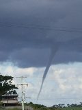
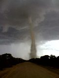
This photo of a cone shaped tornado was taken by Heather Leckie on 23rd December 2008 between 1 and 2pm. Photo location is the intersection of the Monaro Highway and Springs Road at Rock Flat - halfway between Cooma and Nimmitabel.
See also : Forum discussion
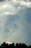
The 19th December 2008 was a marginal day for thunderstorms which could have resulted in an outbreak of severe weather. However, only a few tiny cumulonimbus cells managed to form with a southerly change advancing through the Northern Rivers district - the one depicted here also produced a brief funnel cloud. Photos by Michael Bath. The full sequence of pictures taken on the day is available here.
See also : Forum discussion
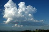

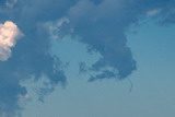
Congesting cumulus north of McLeans Ridges on 2nd December 2008 manages to produce a small funnel cloud. Photos by Michael Bath. The full sequence of pictures taken on the day is available here.
See also : Forum discussion
See also : Forum discussion
A small funnel cloud is observed under a mature thunderstorm at Fairy Hill (between Casino and Kyogle) on 20th September 2008. The first picture puts the position and scale of the funnel into perspective. Photos by Michael Bath. The full sequence of pictures taken on the day including a spectacular hailstorm is available here.
A small funnel under congesting cumulus clouds at Deepwater, NSW on 27th January 2008. Photos by Michael Bath. The full sequence of pictures taken on the day is available here.
Rodney Wallbridge observed a possible tornado over the southern parts of Lismore on 6th January 2008 at 3.20pm. The funnel cloud rotated anticlockwise and moved towards the N or NNE.
See also : Forum discussion
|
Clip1: Lismore Funnel (2mb) Clip 1 |
Clip2: Lismore Funnel X5 speed (430kb) Clip 2 |

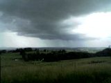
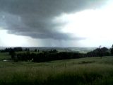
These two photos of a gustando were taken approx 6.40pm, Tues 11th December 2007, from the Manilla-Lake Keepit Rd (approx 6kms west of Manilla) looking south towards Somerton, by Godfrey and Suzi of Manilla Paragliding Australia.
Forum discussion
Report and photos by Jimmy Deguara and Michael Bath
|
Awesome video clip of tornado causing substation explosion by Jimmy Deguara. (8mb) Clip 1 |
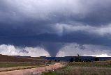
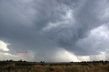
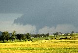
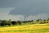
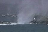
The 26th October 2007 was like any ordinary severe weather setup with an emphasis on supercell development. On top of other widespread severe weather across eastern NSW, a supercell developed and approached on a path to Lismore. Hail to golf ball size was reported 10km SW of Lismore.
With the initial phase weakening and developing new updrafts over Lismore, the storm moved towards Dunoon. The supercell interacted with a likely boundary in the area producing a long lived strong tornado. The debris filled tornado caused an explosion of the local electricity substation and damaged or severely damged several buildings including the local church. The tornado exhibited multi-vortex behaviour and made it to the news media around Australia and the globe over the next 24 hours. The tornado may have been on the ground for at least 25 minutes.
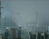
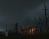
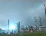
The full set of Dunoon Tornado video stills are available here.
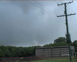
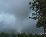
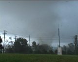
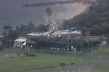
A tornado was intercepted near and over Dunoon on October 26 2007. This was a long lived tornado by Australian standards having been on the ground for up to 25 or 30 minutes. An unofficial rating of this tornado is at least E-F1 possibly E-F2. The rapidly rotating tornado exhibited multi-vortex behaviour and became rather larger in its mature phase. It hit and damaged several buildings with inflow winds ripping off roof tiles from others.
Tornado damage at Dunoon - full set of images here
Pictures of the tornadic supercell earlier in its lifecycle - full set of images here
Further details and discussion about the Dunoon tornado can be found in the Australian Severe Weather Forum thread
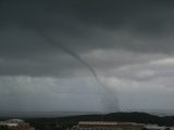
A landspout tornado occurred at Lara near Geelong, VIC on 14 May 2007. The second photo shown here is by Dave Evans.
Forum discussion
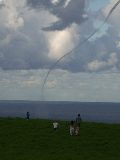
This waterspout photographed from Port Kembla occurred at 4pm 11th February 2007 - Bass Point in Shellharbour can be seen in the background. Photos by Neil Cox and used with permission.
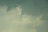
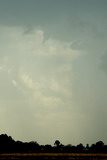
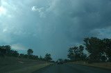
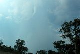
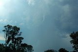
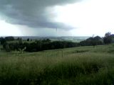
A mid-level funnel on a weakening thunderstorm was observed while driving north of Tenterfield on 24th November 2006. It appears the funnel became established between the downdraft to the north and updraft region on the southeast side of the storm. Photos by Michael Bath. The full sequence of pictures taken on the day is available here.
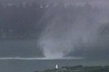
This tornado developed offshore along a boundary and moved inland at La Perouse (Sydney Eastern Suburbs) on 4th August 2006. It ripped a roof off a house and hurled it into the air dumping it about 100 metres away. The tornado went through rapid transformations in and out of condensation funnel. Click to see the video online:
Video of Tornado La Perouse [18mb mpg]
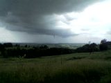
This funnel cloud south of Lismore on 12th February 2006 was photographed by Sue Nelson of Lismore Heights and Graeme of McKees Hill. The funnel lasted at least 20 minutes.
|
Document: tornadoes_australia.html
Updated: 3 July 2012 | [Australian Severe Weather index] [Copyright Notice] [Email Contacts] [Search This Site] [Privacy Policy] |